Property Records & Surveys
Recorded documents and survey materials related to 133 Michigan Ave.
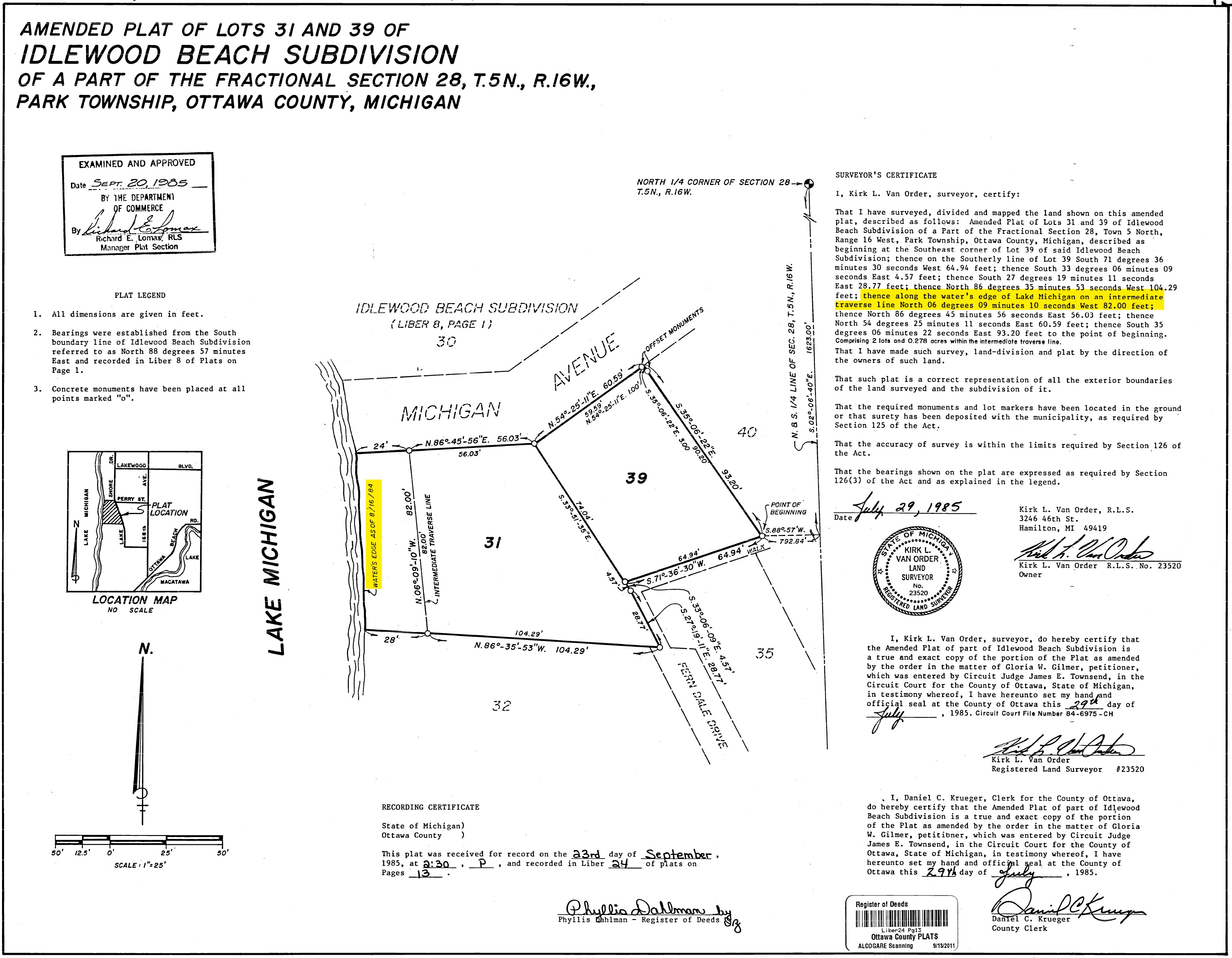
Official Recorded Plat
Idlewood Beach Amended Plat · Liber 24 · Page 13
Ottawa County
State of Michigan · LARA
View official state record →
Local copies are provided for convenience. For the official recorded version, use one of the government sources above.
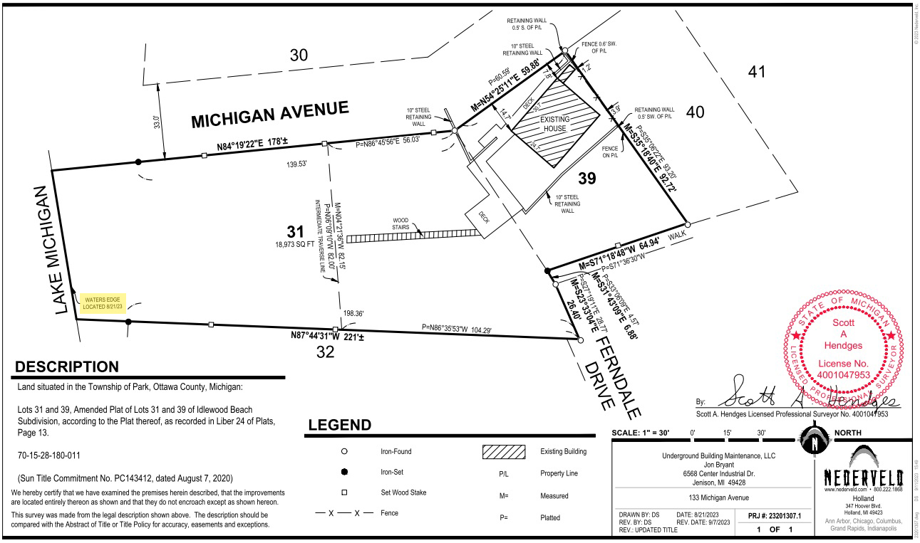
Current Survey
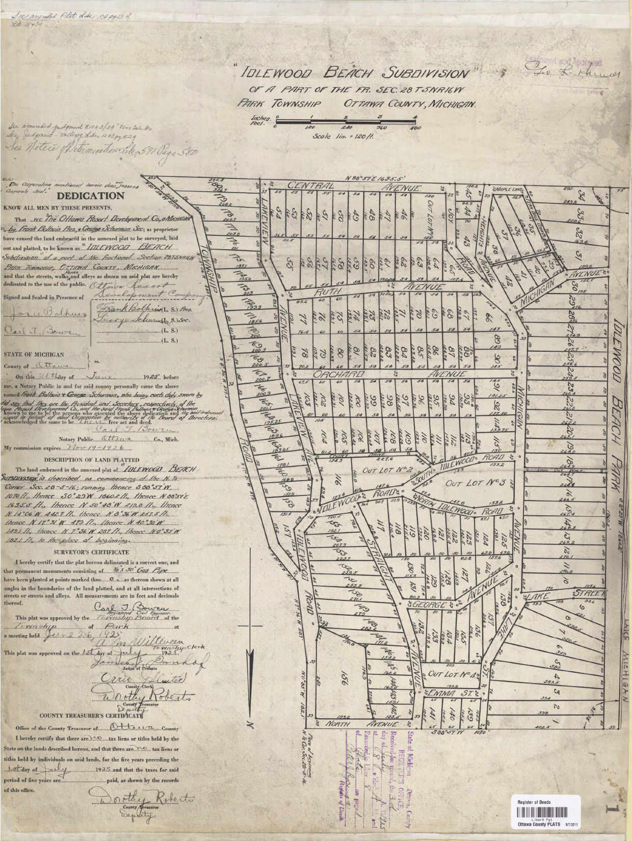
Original Idlewood Beach Plat
Recorded 1925 · Liber 8 · Page 1
Property Boundary Note
Important Property Information
Lot 31, 133 Michigan Ave, consisting of Lot 31 and Lot 39, is unique within the Idlewood Beach Association as the only property in the association where the western side of the property lot line moves with the water's edge. See surveys below per amended plat map, 1985.
This is unlike other waterfront properties in the Idlewood Beach Association where the western edge of their property lines may end before the water's edge depending on the water level of Lake Michigan. Therefore, all public use between western property edges and Lake Michigan water's edge beach areas are excluded for the Lot 31 property marked by round wood timbers on the beach defining the north and south boundaries of Lot 31.
This means that the public cannot congregate anywhere on the beach area of Lot 31, unlike other properties within Idlewood Beach Park as noted on the survey above, 1925.
That being said, this does not stop the public from walking within the area between the water's edge and the ordinary high water mark.
Amended Plat — Lots 31 & 39
Liber 24 · Page 13